COLORADO’S WEST END
Tucked away between Telluride and Moab, and easily accessible from Denver and Salt Lake City – this unique corner of Colorado has a slow-paced lifestyle, tight-knit community, and genuine smiles from locals that will warm your heart. With city-like broadband, abundant economic and natural resources, as well as endless outdoor recreation – you will want to call the West End home…for your family and your business.

GEOGRAPHY
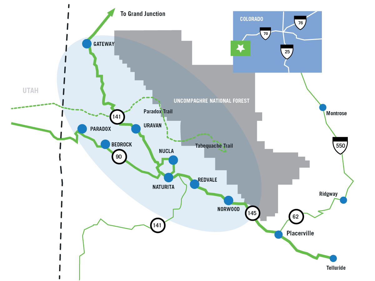
The towns located in the West End are a geographical variety. All communities are located in high-altitude desert land. Nucla, Norwood and Redvale are located atop mesas which surround the Uncompahgre National Forest. Naturita, Paradox and Bedrock are situation in gorgeous river canyons.
Highway 141, which passes through the Town of Naturita, is listed as the second most popular Scenic Byway in Colorado. The Unaweep-Tabequache Scenic Byway links to Interstate 70.
| DISTANCE & TRAVEL TIME FROM WEST END | ||||||||||
| Nucla | Naturita | Norwood | Redvale | Paradox | ||||||
| Destination | Hours | Miles | Hours | Miles | Hours | Miles | Hours | Miles | Hours | Miles |
| Telluride | 1.3 | 56.9 | 1.2 | 52.6 | .49 | 33.1 | 1.0 | 42 | 1.7 | 80 |
| Montrose | 2.0 | 90 | 1.7 | 85.8 | 1.2 | 66.3 | 1.5 | 75.2 | 2.3 | 113 |
| Grand Junction | 2.1 | 104 | 2.1 | 104 | 2.2 | 126 | 2.2 | 114 | 2.5 | 127 |
| Denver | 6.0 | 346 | 6.0 | 346 | 6.0 | 362 | 6.2 | 356 | 6.5 | 369 |
| Colorado Springs | 6.0 | 325 | 6.1 | 321 | 5.4 | 301 | 5.9 | 310 | 6.6 | 349 |
| Aspen | 4.4 | 224 | 4.3 | 224 | 4.6 | 201 | 4.4 | 213 | 4.8 | 247 |
| Salt Lake City | 5.7 | 318 | 5.5 | 313 | 5.4 | 333 | 5.6 | 323 | 4.9 | 288 |
| Albuquerque | 6.0 | 353 | 5.8 | 348 | 6.0 | 359 | 5.9 | 351 | 6.3 | 375 |
| Phoenix | 8.0 | 501 | 7.8 | 497 | 8.9 | 509 | 7.8 | 499 | 7.6 | 477 |
| Los Angeles | 12.7 | 810 | 12.0 | 805 | 12.2 | 825 | 12.1 | 816 | 11.3 | 780 |
ACCESS THE WEST END
Hopkins Airfield [AIB]: Nucla
Hopkins Airfield (AIB) is located in the southwest portion of Colorado within Montrose County, and is owned and operated by the County. The Airport is set on approximately 760 acres west of Colorado State Highway (SH) 97 at an elevation of 5,940 feet above sea level. The Airport is a public-use, general aviation airport that serves the County’s private, business, military and agricultural needs. AIB was developed during World War II, but since that time, the facilities have expanded, and the Airport has become an important asset to the surrounding region and community.
Highway Travel
The West End is located in a remote location within Colorado, but has multiple highways leading to the region. State highways 90, 97, 141 and 145 all serve the area.
Rail
The nearest rail line is located in Delta, Colorado and operated by Union Pacific.
